Mountains
Best Mountains in Colombia 2026: Ultimate Guide to Epic Peaks
Colombia stretches across three distinct mountain ranges that form some of South America's most diverse and accessible peaks. You'll find snow-capped volcanoes rising above coffee plantations, mystical páramo grasslands that feel like another planet, and cloud forests hiding ancient indigenous trails...
Colombia stretches across three distinct mountain ranges that form some of South America's varied and accessible peaks. You'll find snow-capped volcanoes rising above coffee plantations, mystical páramo grasslands that feel like another planet, and cloud forests hiding ancient indigenous trails. This impressive variety means you can trek through high-altitude wetlands at dawn in Boyacá, then stand on a volcanic summit overlooking the Pacific by sunset, often within a single mountain adventure.
The country's unique position where the Andes split into three separate cordilleras creates dramatically different ecosystems and climbing experiences across each range.

Colombia's Three Mountain Cordilleras: An Overview
The Colombian Andes divide into three parallel mountain ranges that run north to south through the country, each with distinct geological characteristics and climbing opportunities. The Eastern Cordillera contains the highest peaks around Bogotá and extends into Venezuela, featuring extensive páramo ecosystems and the country's accessible high-altitude hiking. The Central Cordillera hosts Colombia's active volcanoes and the famous coffee region mountains, while the Western Cordillera runs closest to the Pacific coast and contains some of Earth's biodiverse mountain environments.
This three-range system creates microclimates that shift dramatically over short distances. You might start your day in tropical cloud forest at 1,500 meters, climb through temperate montane forest, and finish above 4,000 meters in alpine páramo conditions where temperatures can drop below freezing any night of the year. The geological diversity also means different rock types and climbing styles, from volcanic scrambles to limestone technical routes.
Each cordillera offers year-round climbing opportunities, but the best conditions vary by location and elevation. The Eastern Cordillera around Bogotá has its driest months from December through March, while the Central Cordillera's volcanic peaks are accessible during the same period. The Western Cordillera receives more Pacific moisture and is generally wetter, but offers impressive biodiversity that you won't find in the drier eastern ranges.
Eastern Cordillera: Boyacá and Cundinamarca Highlands
The Eastern Cordillera contains Colombia's accessible mountain adventures, with numerous peaks within day-trip distance of Bogotá. Cerro de Monserrate (3,152m) serves as many visitors' introduction to Colombian mountain hiking, offering a challenging but manageable climb with spectacular views over the capital city. The mountain can be hiked in about 90 minutes though the altitude affects lowlanders significantly.

The treasures of this cordillera lie in its extensive páramo ecosystems, particularly around Chingaza National Park and Sumapaz Páramo. These high-altitude grasslands support unique plant species like the giant frailejones (Espeletia) and offer some of South America's otherworldly hiking. The páramo trails require proper preparation as weather can change from sunny to freezing rain within minutes, but the landscapes feel like walking on an alien planet.
Laguna de Guatavita combines moderate hiking with significant cultural history as the site of the El Dorado legend. The circular crater lake sits at 3,100 meters and can be reached via a well-maintained trail from the visitor center. Boyacá province offers more remote páramo experiences around Villa de Leyva and Tunja, where you can hike for days through rolling grasslands punctuated by dramatic rock formations.
Pro Tip: Acclimatize in Bogotá (2,640m) for at least two days before attempting páramo hikes above 3,500 meters. The altitude affects even experienced hikers, and páramo weather can turn dangerous quickly.
Central Cordillera: Volcanic Giants and Coffee Region Peaks
Colombia's Central Cordillera hosts the country's dramatic volcanic peaks and some of its challenging mountaineering. Nevado del Ruiz (5,321m) stands as Colombia's accessible snow-capped volcano, though "accessible" is relative when dealing with active volcanic conditions and glacier travel. The peak requires technical mountaineering skills and proper equipment, but offers the rare opportunity to stand on a glaciated summit in a tropical country.
The coffee triangle region around Manizales, Armenia, and Pereira provides excellent base camps for volcanic adventures. Nevado del Tolima (5,215m) and Nevado de Santa Isabel (4,965m) offer similar glaciated climbing with slightly less volcanic activity than Ruiz. These peaks require multi-day expeditions with glacier travel experience, but the combination of technical climbing and striking volcanic landscapes makes them memorable adventures.
For less technical but equally rewarding experiences, the Central Cordillera offers numerous peaks in the 3,000-4,500 meter range. Cerro Bravo (4,000m) near Manizales provides excellent acclimatization hiking with views of the higher volcanic peaks. The Los Nevados National Park area contains multiple day-hike options that showcase the transition from coffee farms through cloud forest to páramo and alpine conditions.
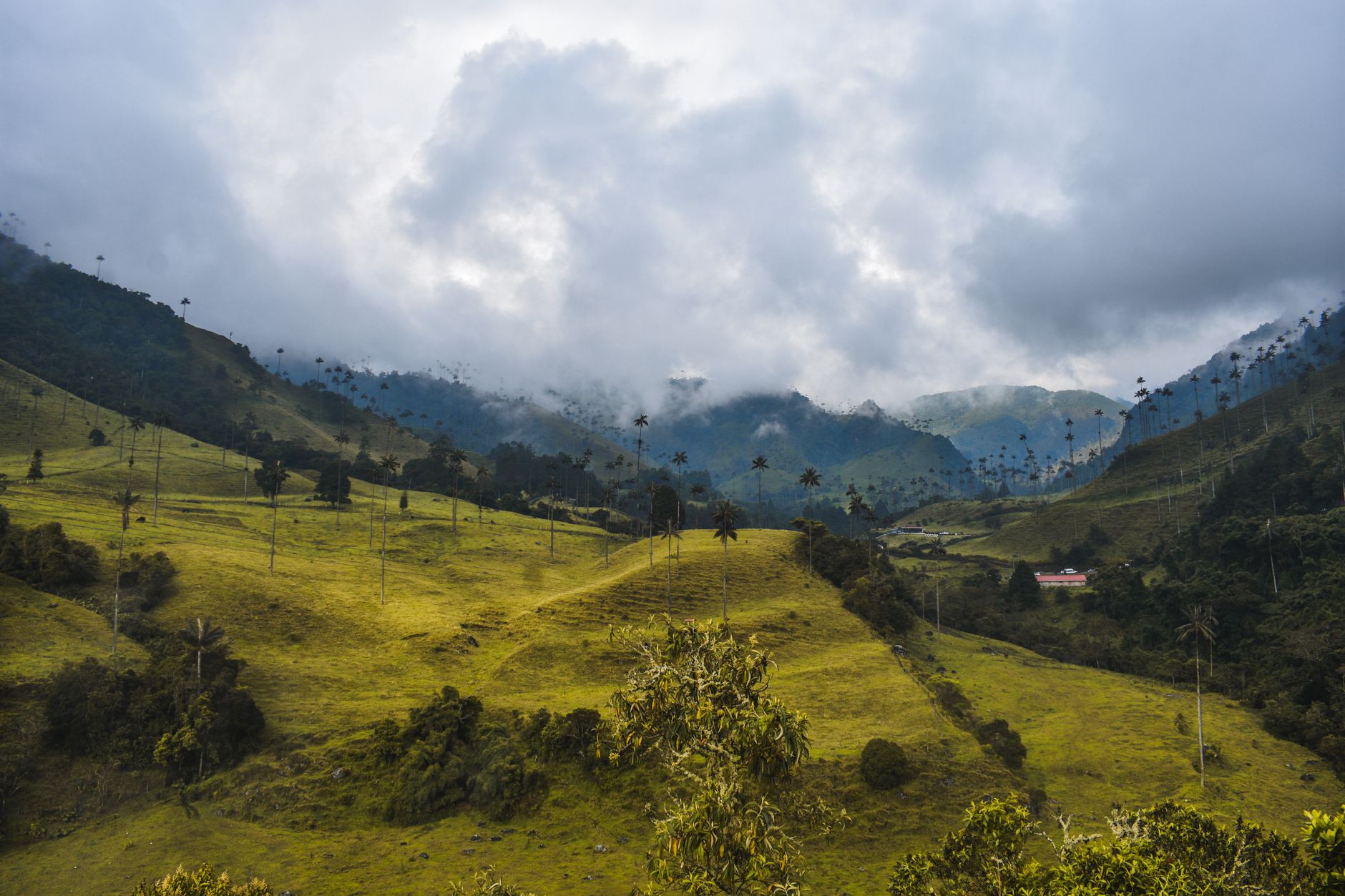
The Valle de Cocora, while not technically a mountain climb, offers one of Colombia's iconic mountain valley experiences. The world's tallest palm trees (some reaching 60 meters) grow in this high-altitude valley surrounded by cloud forest peaks. The full circuit hike takes 5-6 hours and combines easy valley walking with steeper cloud forest sections.
Volcanic Climbing Considerations
All of Colombia's glaciated volcanoes require monitoring volcanic activity reports before attempting climbs. Nevado del Ruiz particularly has periods of increased activity that close climbing access. Check with INGEOMINAS (Colombia's geological service) for current volcanic alert levels, and always hire local guides familiar with current conditions and escape routes.
Western Cordillera: Pacific Coast Mountains and Chocó Peaks
The Western Cordillera receives Pacific moisture, creating some of the planet's biodiverse mountain environments. Farallones de Cali National Park protects peaks that rise directly from near sea level to over 4,000 meters within short horizontal distances, creating an impressive variety of ecosystems from tropical rainforest to alpine páramo.
Pico de Loro (4,100m) and the surrounding Farallones peaks offer challenging multi-day treks through Colombia's pristine mountain wilderness. These areas receive significant rainfall year-round, so waterproof gear is essential, but the biodiversity rivals anything you might experience in the Explore 10+ dramatic Destinations You Must Visit in Switzerland for natural beauty, though with distinctly tropical character.
The Chocó region contains numerous unexplored peaks and some of Colombia's demanding mountain adventures. Cerro Torrá and the peaks around Bahía Solano offer combinations of mountain climbing and coastal access that you won't find elsewhere in Colombia. However, these areas require serious expedition planning and local guide arrangements, as infrastructure is minimal and weather can be extreme.
Access to Western Cordillera peaks typically requires more logistics than the eastern ranges. Many trailheads involve 4WD vehicles, boat transport, or small aircraft to reach, making these adventures more expensive but also more remote and pristine than peaks closer to major cities.
Colombia's Highest Peaks: Climbing and Mountaineering Destinations
Colombia's highest peaks lie in the Sierra Nevada de Santa Marta, an isolated coastal mountain range that rises from sea level to over 5,700 meters in just 42 kilometers horizontal distance. Pico Cristóbal Colón and Pico Simón Bolívar (both 5,730m) are the country's highest summits and among South America's demanding non-technical high-altitude climbs.
Reaching these peaks requires serious expedition planning and typically takes 6-8 days minimum from the nearest road access. The route passes through multiple indigenous territories that require permits and local guide arrangements. The climbing itself is non-technical but extremely demanding due to the rapid altitude gain, extreme weather exposure, and logistical complexity.
Pico Pan de Azúcar (5,560m) in the same range offers a slightly more accessible alternative while still providing the Sierra Nevada's unique experience of climbing from tropical coast to permanent snow in a single expedition. The mountain's position creates its own weather systems that can include everything from tropical storms to alpine conditions within hours.
Warning: Sierra Nevada peaks cross indigenous territories that require advance permits and cultural protocols. Attempting these climbs without proper permissions violates indigenous rights and Colombian law. Always arrange expeditions through licensed operators with indigenous community agreements.
For technical rock climbing, Colombia offers excellent opportunities on granite and limestone throughout all three cordilleras. The Suesca Rocks near Bogotá provide easily accessible sport and traditional climbing on solid sandstone, while areas around Villa de Leyva and San Gil offer longer multi-pitch routes on limestone formations.
High Altitude Preparation
Colombia's highest peaks demand serious altitude preparation. Climbers spend 5-7 days acclimatizing in the 3,000-4,500m range before attempting summits above 5,000m. The rapid elevation changes possible in Colombian mountains can lead to severe altitude sickness if proper acclimatization schedules aren't followed.
Best Hiking Trails and Trekking Routes in Colombian Mountains
Colombian mountain trails range from day hikes accessible by public transport to multi-week expeditions through remote wilderness. Here are the top routes organized by difficulty and time commitment:
Day Hikes (Beginner to Intermediate)
- Cerro de Monserrate (Bogotá) - 3-4 hours round trip, 3,152m elevation, excellent city views and acclimatization hike
- Laguna de Guatavita - 2-3 hours round trip, 3,100m elevation, combines moderate hiking with cultural significance
- Valle de Cocora Circuit (Salento) - 5-6 hours, 2,400-2,800m elevation, iconic wax palm forest and cloud forest
- Piedra del Peñol (Guatapé) - 1 hour climb, 2,135m elevation, famous rock formation with 740 steps to summit
Multi-Day Treks (Intermediate to Advanced)
- Ciudad Perdida Trek (Sierra Nevada) - 4-6 days, reaches 1,200m elevation, ancient indigenous city accessed only on foot
- Chingaza Páramo Circuit - 2-3 days, 3,200-3,800m elevation, pristine páramo ecosystem camping
- Puracé Volcano Trek - 2-3 days, 4,646m summit, active volcano with sulfur springs and páramo landscapes
- Cocuy Circuit (Sierra Nevada del Cocuy) - 3-5 days, 3,000-4,800m elevation, glaciated peaks and alpine lakes
The Ciudad Perdida trek deserves special mention as one of South America's premier archaeological hiking experiences. This 4-6 day trek through Sierra Nevada de Santa Marta reaches the ancient Teyuna indigenous city, predating Machu Picchu by several centuries. The route involves river crossings, steep jungle sections, and significant cultural immersion with indigenous communities.
For páramo specialists, the Sierra Nevada del Cocuy offers Colombia's extensive high-altitude trekking. The range contains over 25 peaks above 4,500 meters and several small glaciers. However, access has been restricted in recent years due to environmental concerns and indigenous territory regulations, so check current status before planning.
Mountain National Parks and Protected Areas in Colombia
Colombia protects its mountain ecosystems through an extensive national park system that requires permits and fees for climbing and trekking activities. Understanding the regulations helps ensure legal access and supports conservation efforts.
Los Nevados National Park protects the Central Cordillera's volcanic peaks and requires advance registration for all overnight activities. Park entry costs 17,500 COP for Colombian residents and 54,500 COP for foreigners as of 2026. Camping permits cost an additional 8,500 COP per night and must be reserved through the park website.
Chingoza National Park offers some of Colombia's accessible páramo hiking but limits daily visitors to protect the ecosystem. Entry requires advance booking through the park system, and guided visits are mandatory for areas. The park provides essential water for Bogotá, so environmental regulations are strictly enforced.
Sierra Nevada de Santa Marta National Park encompasses Colombia's highest peaks but requires complex permitting due to indigenous territories within park boundaries. All climbing expeditions must coordinate with local indigenous authorities and hire certified guides familiar with cultural protocols.
Note: National park regulations change frequently in Colombia. Always verify current permit requirements, fees, and access restrictions on the official SINAP (National System of Protected Areas) website before traveling.
Farallones de Cali National Park protects the Western Cordillera's biodiversity hotspots but has limited tourism infrastructure. Activities require special permits and local guide arrangements. The park experiences significant rainfall year-round, so waterproof equipment is essential.
Permit and Fee Summary
- National Park Entry - 17,500-54,500 COP depending on residency status
- Camping Permits - 8,500 COP per night per person
- Guide Requirements - Mandatory in high-altitude and indigenous territory areas
- Indigenous Territory Access - Separate permits required, arranged through local authorities
Private reserves and regional parks often offer more flexible access than national parks. Areas around Best Places to Visit in USA: Top Destinations for Every Traveler might have similar permit complexity, but Colombia's system specifically balances conservation with indigenous rights recognition.
Planning Your Colombian Mountain Adventure: When to Visit and What to Pack
Colombia's proximity to the equator means mountain weather is determined more by altitude and local geography than seasons, but regional dry and wet periods significantly affect climbing conditions. The optimal climbing season runs from December through March when regions experience lower rainfall and clearer skies.
The Eastern Cordillera around Bogotá has its driest months from December through March, with occasional clear periods in July and August. Páramo conditions can include freezing temperatures and sudden storms any time of year, so prepare for winter conditions even during dry months.
Central Cordillera volcanic peaks are accessible during the December-March dry season when glacier conditions are more stable and weather windows for summit attempts are more predictable. Coffee region mountains can be climbed year-round but expect afternoon rains during wet season months.
The Western Cordillera receives Pacific moisture throughout the year, making it Colombia's wettest mountain region. The "less wet" season runs from January through March, but waterproof gear is essential regardless of timing.
Essential Mountain Gear for Colombia
Colombian mountain conditions require gear that handles tropical heat, freezing páramo temperatures, and significant rainfall depending on elevation and region:
- Layered Clothing System - Base layers, insulating layers, and waterproof shell for temperature ranges from 5°C to 35°C
- Waterproof Rain Gear - High-quality rain jacket and pants, essential in all Colombian mountain regions
- Warm Sleep System - Sleeping bag rated to -5°C minimum for páramo camping, -15°C for glaciated peaks
- Sun Protection - High-SPF sunscreen and glacier glasses for high-altitude UV exposure
- Navigation Equipment - GPS device or smartphone with offline maps, as trail marking varies significantly
For glaciated peaks like Nevado del Ruiz, add mountaineering-specific gear including crampons, ice axe, harness, and crevasse rescue equipment. Rental options exist in Manizales and Bogotá, but sizes and availability are limited.
Altitude sickness medication is recommended for anyone planning to climb above 3,500 meters, especially if arriving directly from sea level. Acetazolamide (Diamox) helps with acclimatization but requires prescription and medical consultation before travel.
Logistics and Transportation
Colombian mountain adventures begin from major cities with good transportation infrastructure. Bogotá serves as the gateway to Eastern Cordillera peaks and has the selection of outdoor gear shops and mountain guide services. Manizales and Pereira provide access to Central Cordillera volcanoes, while Cali is the jumping-off point for Western Cordillera adventures.
Domestic flights connect major cities, but budget 1-2 days for ground transportation to remote trailheads. Many mountain areas require 4WD vehicles or have limited public transport, so factor transportation costs into expedition budgets. Hiring local drivers familiar with mountain roads often proves safer and more efficient than self-driving in remote areas.
Frequently Asked Questions
What is the highest mountain in Colombia? Pico Cristóbal Colón and Pico Simón Bolívar share the distinction at 5,730 meters, both located in the Sierra Nevada de Santa Marta. These peaks require serious expedition planning and can take 6-8 days to reach from the nearest road access.
Do you need permits to climb Colombian mountains? Yes, significant peaks require permits through the national park system or indigenous territory authorities. Fees range from 17,500-54,500 COP for park entry plus additional camping and guide fees. Some areas like Sierra Nevada de Santa Marta require complex indigenous community permissions arranged weeks in advance.
What is the best time of year to hike in the Colombian Andes? December through March offers the driest conditions across mountain regions, though Colombia's equatorial location means altitude affects weather more than seasons. The Western Cordillera remains wet year-round, while páramo areas can experience freezing conditions any time of year.
Are the Colombian mountains safe for tourists? Mountain areas generally have lower security risks than urban regions, but remote locations require careful planning. Use established tour operators for technical climbs and indigenous territory access. Current security information should be verified with local authorities and embassy sources before traveling to remote mountain regions.
What gear do I need for mountain climbing in Colombia? Essential items include layered clothing for temperature ranges from 5°C to 35°C, waterproof rain gear, warm sleeping system, sun protection, and navigation equipment. Glaciated peaks require technical mountaineering gear including crampons and ice axes, available for rent in major cities but with limited selection.
Colombia's mountains offer adventures that combine the technical challenges found in places like Top Things to Do in Morocco 2026: A Complete Travel Guide with uniquely South American biodiversity and indigenous culture. From accessible páramo day hikes to serious high-altitude expeditions, these peaks provide mountain experiences you won't find elsewhere on the continent. The combination of three distinct cordilleras, active volcanoes, and some of the world's rapid altitude changes creates climbing opportunities that challenge and reward mountaineers of all experience levels.